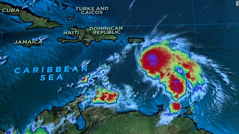
News Americas, MIAMI, FL, Fri. Sept. 30, 2016: Hurricane Matthew has strengthened to a category 5 hurricane – the highest category of the Saffir-Simpson scale and the strongest in the Atlantic since Hurricane Felix in 2007, the National Hurricane Center in Miami said at 11 p.m. tonight.
Hurricanes reaching Category 5 are considered major hurricanes because of their potential for significant loss of life and damage.
At 11 p.m., Matthew was about 80 miles north east of Punta Gallinas, Colombia and about 440 Miles southeast of Kingston, Jamaica with winds now at 160 mph. Matthew is moving
just south of due west near 7 mph (11 km/h). A turn toward the west-northwest is forecast on Saturday, followed by a turn toward the northwest on Sunday. On the forecast track, the center of Matthew will move north of the Guajira Peninsula tonight, move across the central Caribbean Sea on Saturday, and be approaching Jamaica late Sunday.
Matthew is expected to remain a powerful hurricane through Sunday. A hurricane watch is in effect right now for Jamaica, meaning that hurricane conditions are possible within the watch area.
Rainfall totals of 10 to 15 inches with isolated maximum amounts of 25 inches are expected across Jamaica and southern and southwestern Haiti. These rains may produce life-threatening flash flooding and mud slides.
A tropical storm watch is in effect for Colombia and the Venezuela border to Riohacha as well as for Haiti from the southern border with the Dominican Republic to Port-Au-Prince which means that tropical storm conditions are possible within the watch area, generally within 48 hours.
Rainfall totals of 2 to 4 inches with isolated higher amounts are expected over Aruba, Bonaire and Curacao through Saturday. Rainfall totals of 2 to 4 inches with isolated higher amounts are expected along the coast of Colombia from the Venezuelan border to Riohacha. Rainfall totals of 1 to 2 inches with isolated higher amounts are expected along the coast of Venezuela from Coro to the Colombian border.
Swells generated by Matthew are expected to affect portions of the coasts of Puerto Rico, Hispaniola, Jamaica, Aruba, Bonaire, Curacao, Venezuela, and Colombia during the next few days. These swells are likely to cause life-threatening surf and rip current conditions.


