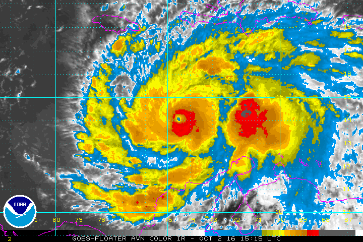
News Americas, MIAMI, FL, Sun. Oct. 2, 2016: Hurricane Matthew remains a powerful category four hurricane today as it has three Caribbean islands under a hurricane warning and three under a hurricane watch.
At 11 a.m., the National Hurricane Center in Miami reported a hurricane warning was in effect for Jamaica, Haiti and Cuban provinces of Guantanamo, Santiago de Cuba, Holguin, Granma,
and Las Tunas.
A Hurricane Warning means that hurricane conditions are expected somewhere within the warning area. A warning is typically issued 36 hours before the anticipated first occurrence of tropical-storm- force winds, conditions that make outside preparations difficult or dangerous. Preparations to protect life and property should be rushed to completion.
A hurricane watch is also in effect for the Cuban province of Camaguey, Southeastern Bahamas, including the Inaguas, Mayaguana, Acklins, Crooked Island, Long Cay, and Ragged Island and the Turks and Caicos Islands. A Hurricane Watch means that hurricane conditions are possible within the watch area. A watch is typically issued 48 hours before the anticipated first occurrence of tropical-storm-force winds, conditions that make outside preparations difficult or dangerous.
A tropical storm warning is also in effect for the Dominican Republic from Barahona westward to the border with Haiti while a tropical storm watch is in effect for the Dominican Republic from Puerto Plata westward to the border with Haiti. A Tropical Storm Warning means that tropical storm conditions are expected somewhere within the warning area within 36 hours while a Tropical Storm Watch means that tropical storm conditions are possible within the watch area, generally within 48 hours.
Matthew is set to turn toward the northwest later today, followed by a turn toward the north tonight. On the forecast track, the center of Matthew will approach southwestern Haiti and Jamaica on Monday.
Maximum sustained winds are near 140 mph (220 km/h) with higher gusts expected. Matthew was now about 350 miles south, south west of Port-Au-Prince, Haiti’s capital and about 310 miles southeast of Kingston, Jamaica.
Matthew is expected to produce total rain accumulations of 15 to 25 inches over southern Haiti, with possible isolated maximum amounts of 40 inches and accumulations of 8 to 12 inches with isolated maximum amounts of 16 inches in western Haiti, while northern sections of Haiti can expect lower amounts in the 1 to 3 inch range with localized maximum near 5 inches.
Matthew is expected to produce total rain accumulations of 10 to 20 inches over eastern Jamaica, the Dominican Republic, and eastern Cuba, with possible isolated maximum amounts of 25 inches that will likely produce life-threatening flash floods and mud slides.
Matthew is also expected to produce total rain accumulations of 8 to 10 inches over the southeastern Bahamas, with possible isolated maximum amounts of 15 inches and 2 to 4 inches, with possible isolated maximum amounts of 6 inches over the Turks and Caicos Islands.
Matthew is expected to produce additional rain accumulations of 1 to 2 inches over Aruba, Curacao, and Bonaire through Sunday and rain accumulations of 2 to 4 inches over northern Colombia, northwest Venezuela, and western Jamaica, with possible isolated maximum amounts of 6 inches.


